PROJECT G4RS
“Safer Roads Today, Stronger Communities Tomorrow.”

VISION
Project G4RS strives to create safer road networks that promote a healthier and more economically robust Baguio City. Through this initiative, we aim to reduce vehicular accidents and foster a culture of road safety across all road users.
Partners and Stakeholders:
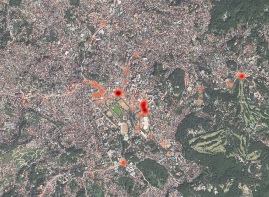
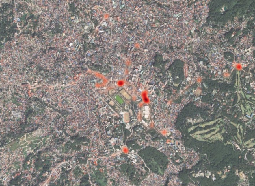
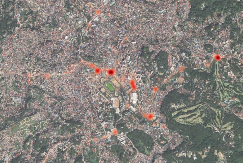
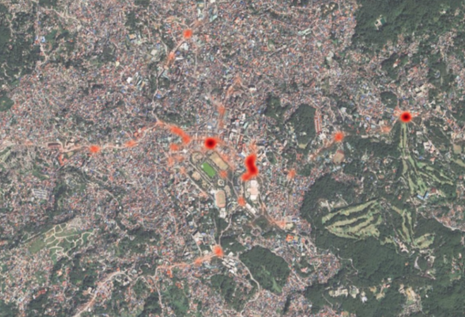
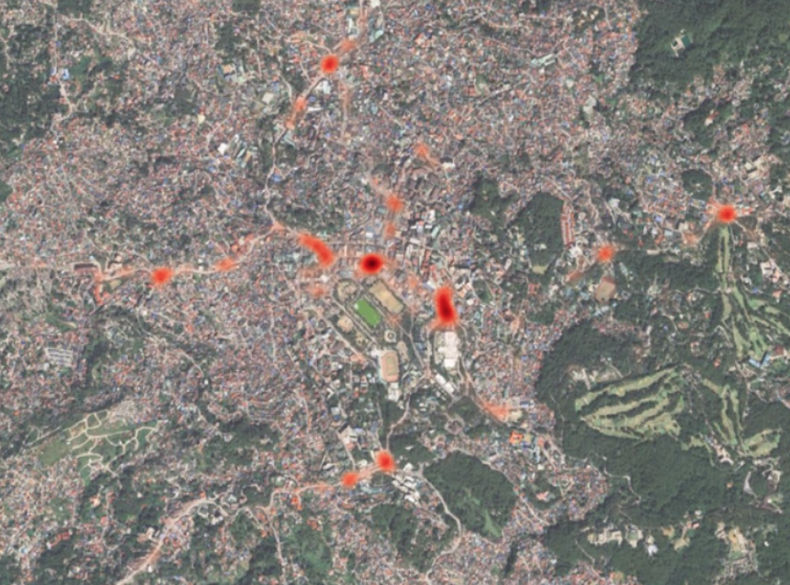
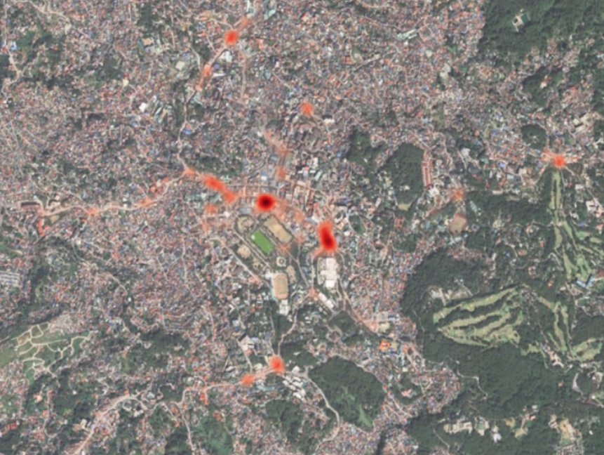
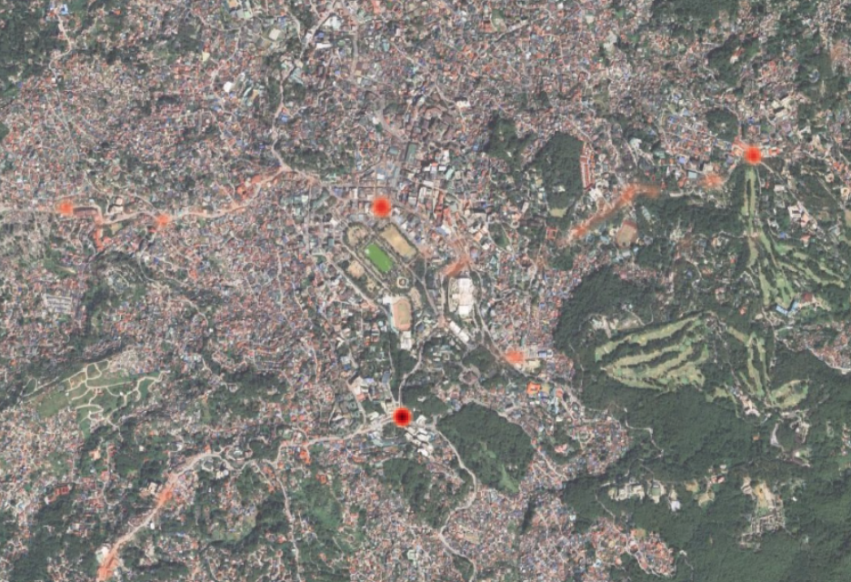
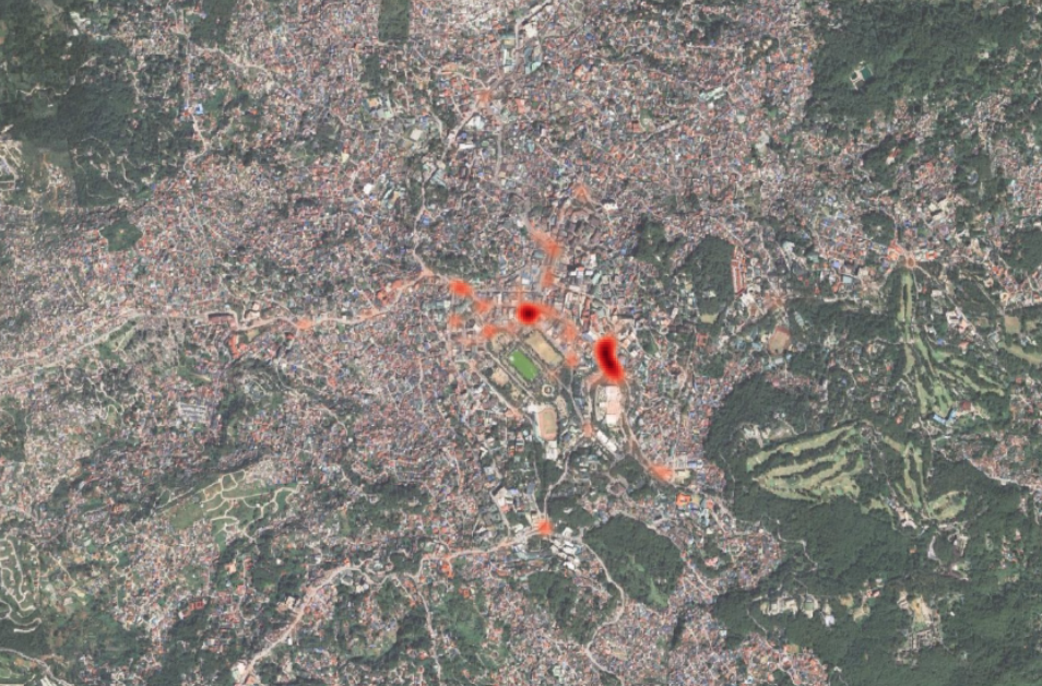
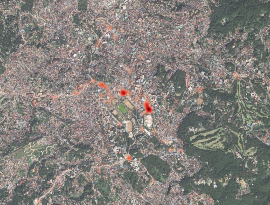
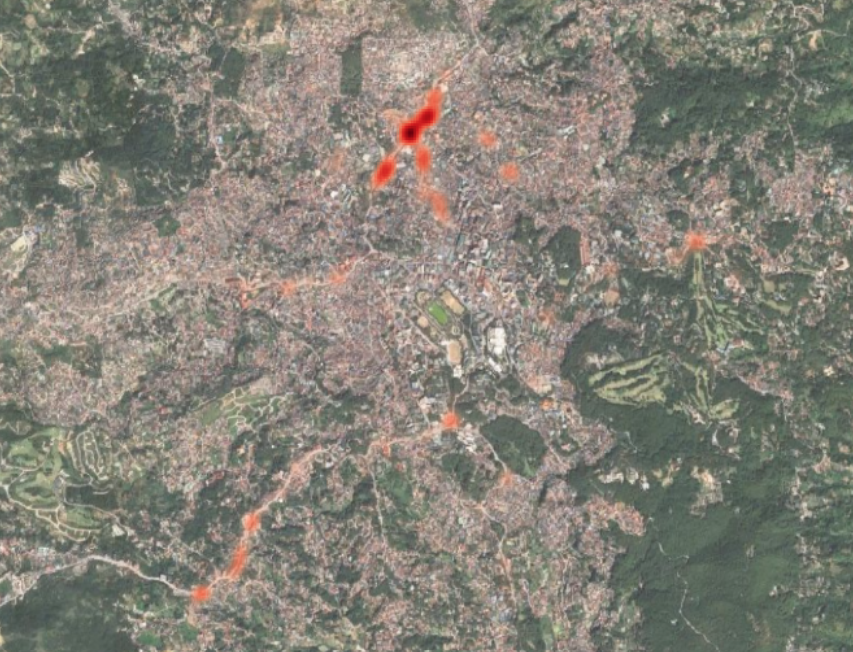
Baguio City Road Crash Heatmap (2016-2026)
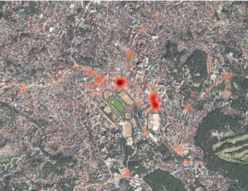 2016-2025
 2016-2025
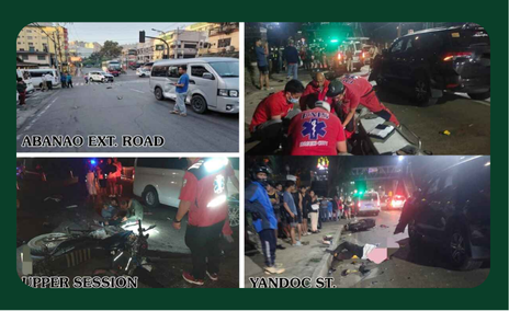
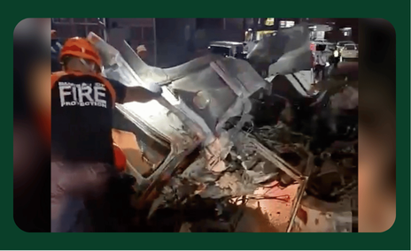
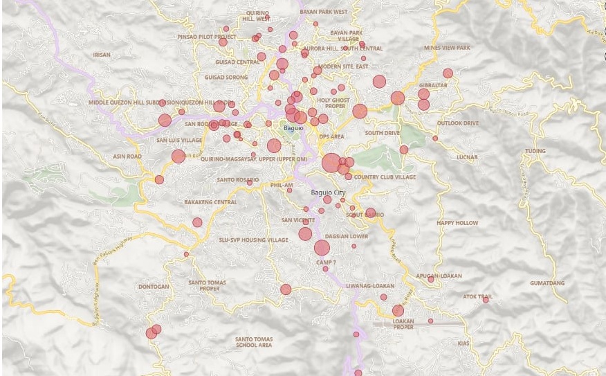
Vehicular Traffic Accidents Hotspots (2016-2025)
 2025
2025
 2024
2024
 2023
2023
 2022
2022
 2021
2021
 2020
2020
 2019
2019
 2018
2018
 2017
2017
 2016
2016
Barangay-Level Vehicular Traffic Accident Risk Map of Baguio City
Risk Map of Vehicular Traffic Accidents in Baguio City
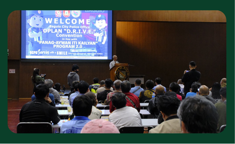
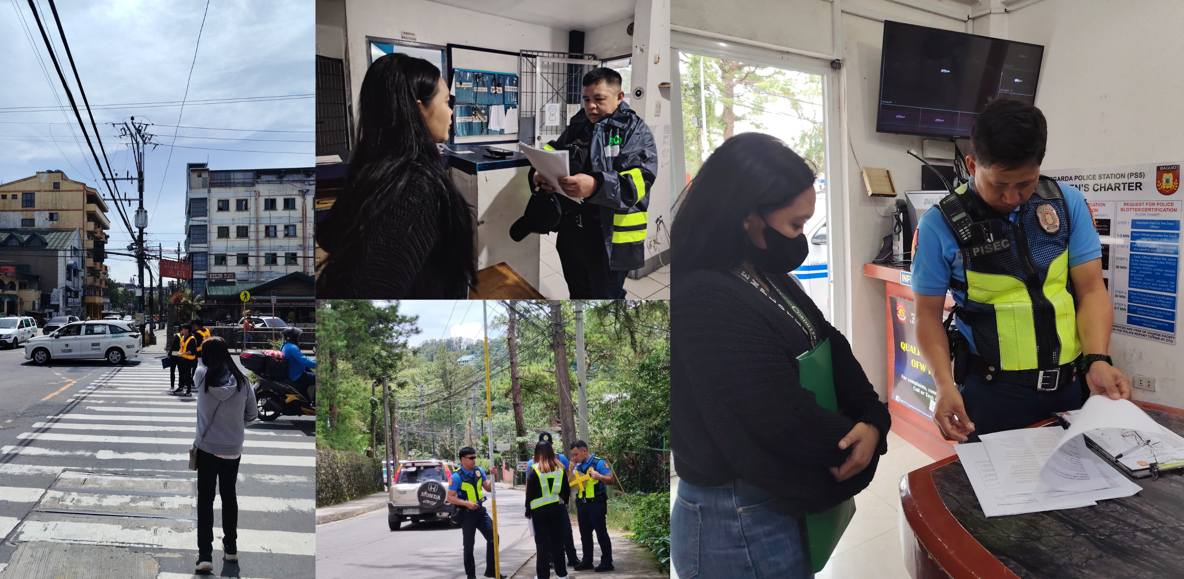
About Project G4RS
-

Project G4RS is an innovative initiative spearheaded by the University of the Cordilleras in collaboration with theBaguio City Police Office (BCPO) and the Local Government Units (LGUs) of Baguio City. Funded by the Department of Science and Technology – Philippine Council for Industry, Energy and Emerging Technology Research and Development (DOST-PCIEERD), this project uses cutting-edge Geographic Information Systems (GIS) and data analytics to mitigate road accidents in Baguio City. The primary focus of Project G4RS is to analyze traffic accident data, identify accident-prone areas, and provide a decision-support platform for informed infrastructure planning and policymaking.
-
Key Objectives

Accident Detection & Prevention
Using GIS and data analytics to identify high-risk areas for traffic accidents.

Data-Driven Decision Making
Applying time-series and spatial analysis to assist in policy formation and city infrastructure planning.

Road Safety Enhancement
Aimed at reducing traffic-related accidents to improve public safety and promote sustainable urban mobility.
Impact of Project G4RS on Baguio City
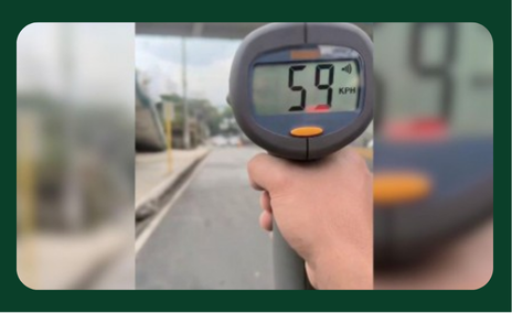
Reducing Road Accidents: Through data-driven insights, the project aims to reduce the frequency and severity of traffic accidents in Baguio City, ultimately making the city’s roads safer for everyone. Improving Traffic Infrastructure : By identifying areas with high accident rates, city planners can prioritize infrastructure improvements, such as better signage, pedestrian walkways, and traffic signal systems. Enhanced Public Health and Economic Benefits : Fewer accidents result in fewer injuries and fatalities, leading to lower healthcare costs and enhanced quality of life for residents. Safer roads also contribute to smoother traffic flow, reducing congestion and supporting a more productive economy.
Future Goals and Expansion
Expanding GIS Analysis to Other Cities: Plans to extend the GIS and data analytics model to other urban areas in the Philippines to replicate the success of Project G4RS in Baguio City. Long-Term Data Sustainability: Establishing a continuous data collection system that feeds into local governance platforms, ensuring that policies adapt over time to changing traffic patterns and technological advancements
Want to learn more?
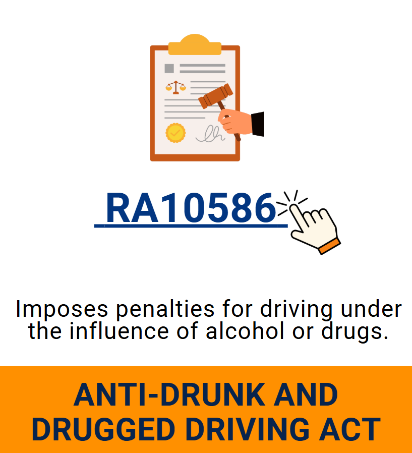
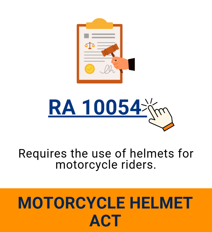
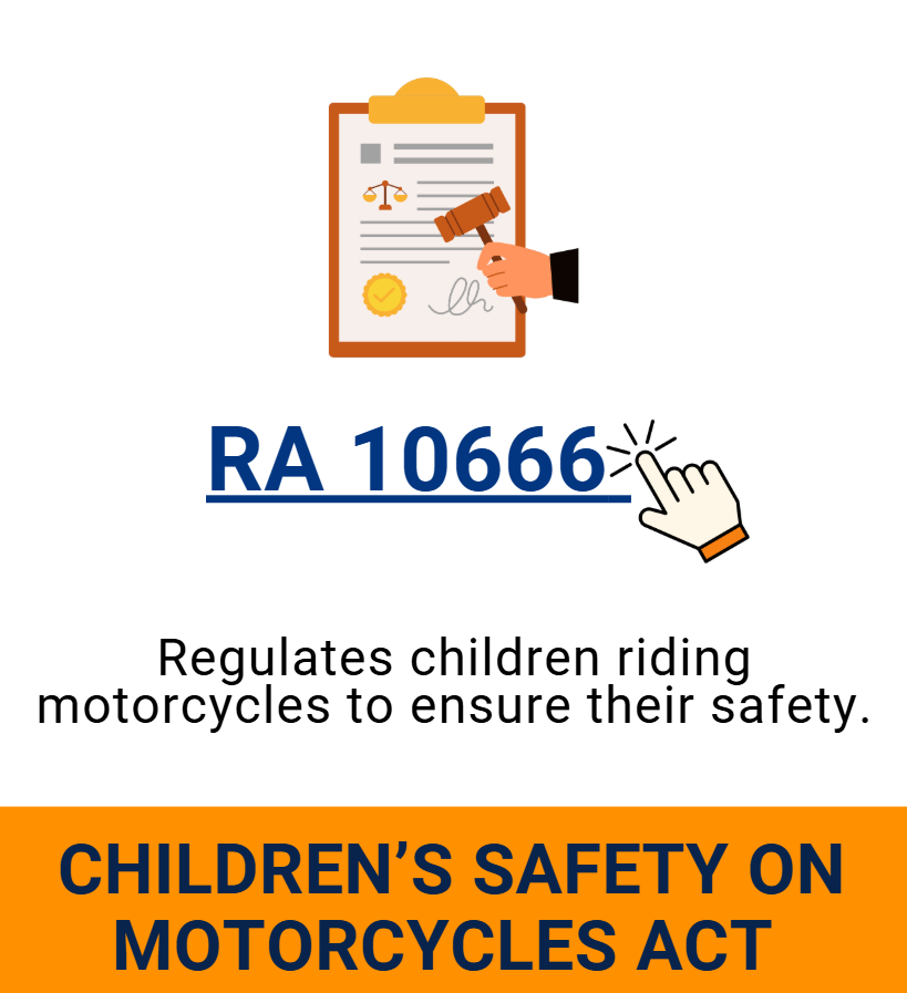
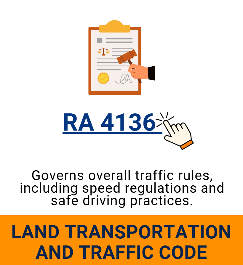
ROAD SAFETY


Meet the Team

DR. NATHANIEL VINCENT LUBRICA
PROJECT LEADER

DR. DEBBIE KARYL ARQUERO
Project Staff Level 3

DR. JOAN PERALTA
Specialist

ENGR. DENMEL PAUL SAAVEDRA
System Developer
ENGR. KAREN ALLEN SUAREZ
System Developer

DR. NICA TOGANA
Data Analyst (Qualitative)

DR. DJOANA TABAO-ICAN
Data Analyst (Quantitative)
DR. LEAH DONATO
Data Analyst (Quantitative)